Efficient Map Visualization with Ultimaps
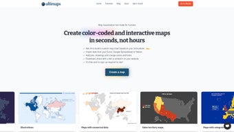
Ultimaps is a powerful web application designed for creating color-coded interactive maps effortlessly. The platform allows users to import data from various sources, including Excel and Google Spreadsheets, to generate maps that are not only visually appealing but also informative. Customization options are abundant, enabling users to tailor their maps with personalized color schemes, pins, drawings, and font adjustments. Each map is automatically color-coded based on the imported data, complete with an adjustable legend for clarity.
The functionality of Ultimaps extends to interactive features such as tooltips and popup windows, making it easy to engage audiences. Users can publish and share their maps through links or embed them on websites. The application is mobile-friendly, ensuring accessibility on various devices. With an auto-save feature, users can easily return to their projects. Ultimaps offers a free tier alongside a subscription-based Pro version for enhanced capabilities.